The markings are unfamiliar: carved contours that now only hint at a lost landscape from long ago. Nonetheless, a large, mysterious slab of stone recently rediscovered in France looks like it might just be the oldest known map in Europe.
In a new study, researchers re-examined the Saint-Bélec slab – an intricately carved, partly broken slab of stone first found in 1900, before being set aside in a castle and largely forgotten about for over 100 years.
Only now are modern archaeologists reappraising the slab and learning its significance – specifically, that it could in fact represent the most ancient cartographical depiction of known land in Europe.
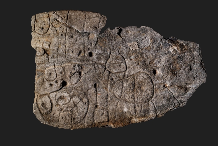
 The Saint-Bélec slab. (D. Gliksman/Inrap)
"This is probably the oldest map of a territory that has been identified," first author of the study, Clément Nicolas from Bournemouth University in the UK, told the BBC.
"There are several such maps carved in stone all over the world. Generally, they are just interpretations. But this is the first time a map has depicted an area on a specific scale."
Quite how the Saint-Bélec slab made its way into the present day isn't fully understood, but it's definitely been a strange journey.
In more recent times, the stone was found in 1900 by the French prehistorian Paul du Chatellier, who excavated the engraved slab from an ancient burial mound in the town of Leuhan in the Brittany region of north-western France.
As for what the carvings on the almost 4-meter-long (13 ft) slab were meant to signify, du Chatellier wasn't sure. He observed at the time that some scholars interpreted the markings as a shapeless human representation, or perhaps a picture of a beast – but also suggested the meanings might only be uncovered in future research.
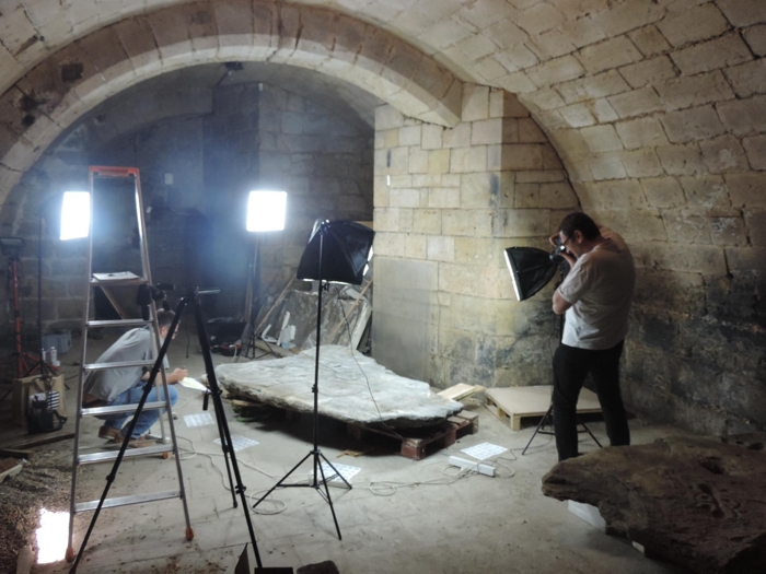
 Stored in the cellar of a castle. (P. Stephan, Clément Nicolas, Yvan Pailler)
"Let us not let ourselves be led astray by fantasy, leaving it to a Champollion, who will perhaps find himself one day, to read it to us," du Chatellier wrote.
Despite the grand promise, du Chatellier reserved the slab in his private collection, before it was sold by his children to the French Museum of National Archaeology, which stored it in isolation for several decades in the niche of a castle moat.
It was 2014 when the largely forgotten Saint-Bélec slab was finally rediscovered again, found in a cellar of the castle. A few years later, Nicolas and his international team set about conducting the first modern investigation of the slab, using high-resolution 3D surveying techniques to record and examine the morphology and chronology of the stonework.
One of the slab's great mysteries is what a map like this was doing in the Saint-Bélec burial mound in the first place. The tomb in question is thought to date back to the end of the early Bronze Age (about 1900–1640 BCE), but the slab itself is likely older, perhaps being carved earlier in the early Bronze Age, possibly decades or centuries before, the researchers think.
If they're right, it means this ancient map slab was being reused for some reason as part of the burial process, forming one of the walls of the stone barrow, with the engraved side facing inward to the tomb, meaning the markings weren't exposed to the elements for thousands of years, which helps to explain why they remain relatively unweathered to this day.
According to the researchers, the map-like engravings and motifs carved on the surface of the slab provide a rough three-dimensional (3D) match to the river region in which the ancient burial mound existed.
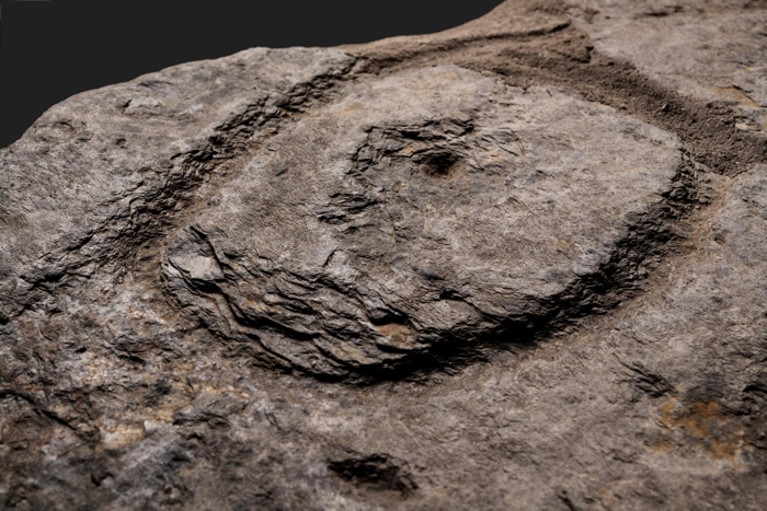
 The Saint-Bélec slab. (D. Gliksman/Inrap)
"A key point is that the engravers seem to have modified the original surface relief of the slab to create the desired 3D-form that compares to the topography of the surrounding landscape," the researchers write in their paper, noting that the Saint-Bélec barrow overlooks the valley of the mapped Odet River region.
"[We] confirm a good correspondence between the carvings and the topography, with similar results to ethnographic solicited maps. Such correlations give ... an idea of the possible scale of the space represented: an area c. 30 km long and 21 km wide."
What's less certain is what other motifs carved into the slab might represent, but it's possible they could reflect the location of early Bronze Age settlements, other barrow sites, field systems, and tracks, the team suggests.
If so, it might be that the map reflected a kind of organizational plan of land use and ownership according to the political and economic rulers of the early culture that carved this object.
"There was undoubtedly a justification for carving this work in stone … leaving a mark," explains one of the team, archeologist Yvan Pailler from the University of Western Brittany.
"Making a cartography like that … is often linked to the affirmation of a power, of an authority over a territory. This is the general context of achievement that occurs in the Early Bronze Age, at a time when we see the emergence of highly hierarchical societies."
In such an interpretation, it's possible the slab was later cast into the grave as a subsequent rejection of the power and property system of this ruling elite – to be buried for thousands of years, before its enigmatic divisions would finally communicate the lay of the land once more.
The findings are reported in Bulletin de la Société préhistorique française.
#Humans | https://sciencespies.com/humans/forgotten-stone-slab-may-actually-be-the-oldest-known-map-in-europe/
No comments:
Post a Comment