Across the Caribbean this week, island residents docked boats, emptied grocery stores, and boarded up buildings in preparation for Hurricane Dorian, which became a Category 1 storm on Wednesday.
Meanwhile, high up in Earth's orbit, satellites belonging to the National Oceanic and Atmospheric Administration (NOAA) watched the hurricane form and churn.
The storm has passed Puerto Rico and the Virgin Islands and is now over open waters, where the National Hurricane Center (NHC) expects Dorian to gain strength.
The storm's expected path shows it heading toward Florida, where it could make landfall as a Category 4 hurricane on Monday.
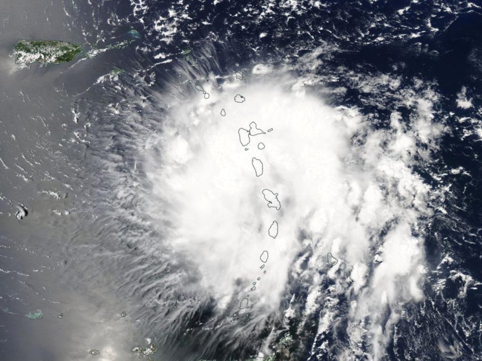
Dorian passed near the islands of Barbados and St. Lucia on Tuesday night as a tropical storm.
Barbados residents piled sand to prevent flooding and rushed to supermarkets to purchase supplies.
Parts of Barbados lost power, and boats on St. Lucia filled with water, but the islands emerged relatively unscathed.
For local forecasts, watches, and warnings related to Tropical Storm #Dorian, you can follow these official accounts:
Puerto Rico and the US Virgin Islands: @NWSSanJuan
British Virgin Islands: @abmetservice
Dominican Republic: @onametRD pic.twitter.com/gULKPC9NF1
— National Hurricane Center (@NHC_Atlantic) August 28, 2019
By Wednesday morning, satellites revealed the storm's cloud pattern becoming more organized.
The NHC upgraded Dorian to a hurricane on Wednesday afternoon as it passed over the US Virgin Islands, with wind speeds of 74 mph (119 km/h).
 Tropical storm Dorian, before it became a hurricane, over the Leeward Islands, August 27, 2019. (NASA Worldview/EOSDIS/Handout)
After the NHC issued a hurricane watch for Puerto Rico, the territory's new governor, Wanda Vázquez Garced, declared a state of emergency and made 360 shelters available to people who still have damaged roofs from Hurricane Maria.
For the most part, however, the storm spared Puerto Rico.
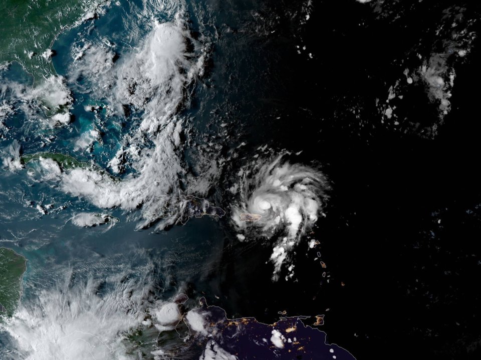
By Wednesday evening, Hurricane Dorian had developed a definitive eye, the NHC said.
 (NASA GOES-East)
"All indications are that by this Labor Day weekend, a powerful hurricane will be near the Florida or southeastern coast of the United States," the NHC said in a statement.
Dorian could bring 4 to 8 inches (10 to 20 centimeters) of rainfall to coastal areas of the southeastern US, with up to 12 inches (30 centimeters) in some locations. This rain could cause "life-threatening" flash floods, the NHC said.
Florida Governor Ron DeSantis declared a state of emergency on Wednesday.
"It's important for Floridians on the East Coast to monitor this storm closely. Every Florida resident should have seven days of supplies, including food, water and medicine, and should have a plan in case of disaster," DeSantis said in a release.
"The state stands ready to support all counties along the coast as they prepare."
This article was originally published by Business Insider.
More from Business Insider:
#Nature | https://sciencespies.com/nature/satellite-images-show-hurricane-dorian-gaining-strength-over-the-caribbean/
No comments:
Post a Comment